This English Village Is Rising 2cm A Year, And Scientists Have No Idea Why
By Amanda Froelich Truth Theory
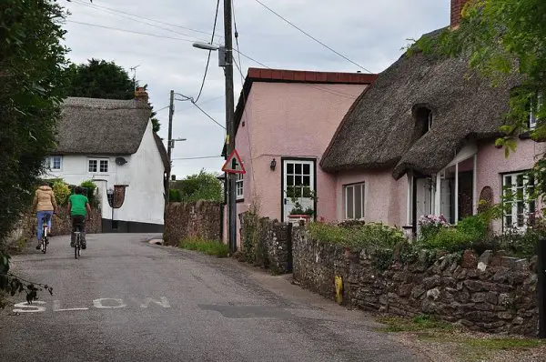
Devonshire, England, receives plenty of foot traffic each year. This is because the county encompasses fossil cliffs, medieval towns, and moorland national parks. But aside from its tourist attractions, there is another reason some people are choosing to visit Devon — the village is rising 2 cm a year, and scientists have no idea why.
As The Telegraph reports, scientists from the University of Nottingham’s spin-off company Geomatic Ventures Limited (GML) were the first to spot the topographical change. Between 2015 and 2017, they compiled satellite images to create the first country-wide map of land motion in Britain.
According to Dr. Andy Sowter, Chief Technical Officer at GVL, this kind of uplift is usually spotted where there has been mining work in the area. When pumps are switched off, water gradually seeps back into the ground. “But I contacted the British Geological Society to ask if there was any history of mining in the area and there is none. Willand is in the middle of nowhere, and there were no mines, so we have no idea what is going on,” said Sowter.
“For people living in the village it would be imperceptible and there is unlikely to be any structural damage, but it is concerning that there is a high speed railway line running in the area and the M5,” he added. “If you’re running a railway over that you may notice you have to maintain a bit of rail a little more if the ground is rising.”
The rising area is elliptical in shape and measures approximately 1.2 miles (2km) wide. Experts theorize that the answer “lies deep underground,” as both fields and urban areas are rising together. It is possible the rising ground is the result of a large environment discharge, or a huge leak.
“It’s fairly sizable, the whole town is moving here. I think the authorities definitely need to go down there and investigate what is going on,” said Sowter. “If it is down to liquid seeping underground, or some sort of discharge of waste then that could be a threat to the environment. If this is not a natural occurrence then it is symptomatic of something happening underground so it’s important to find our what that is,” he concluded.
Using a technique called satellite interferometry, researchers were able to create a map that shows the topographical changes. Commented Dr. Stephen Grebby, assistant Professor in Earth Observation at Nottingham University: “With the new map we are able to better understand how the entire UK landscape is being affected by various natural and anthropogenic processes.”
“Whilst providing us with detailed information to study the individual mechanisms of these processes, the technique also offers a means of identifying and mitigating any potential risk that these may also pose to infrastructure, society and the environment,” he added.
What are your thoughts? Please comment below and share this news!
Source: The Telegraph
Image Featured/Credit: Wikimedia Commons
.jpg#filehistory)
Leave Comment: