GPS Navigation Highlights The Distance Wolf Packs Put Between Themselves
Tags: News

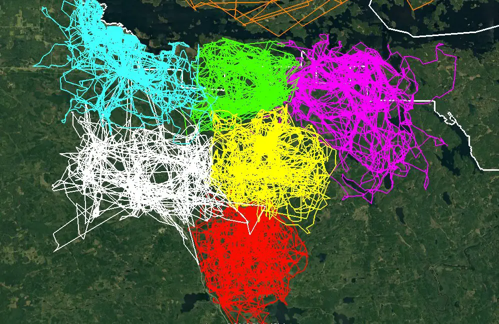
The Voyageurs Wolf Project created a framework that showed images of wolf packs and the distance they had between each pack. GPS navigation was used in Voyageurs National park to create the structure, and this is really an excellent representation of the abhorrence one wolf pack shows towards the other.
Read: Scientists Predict the Amazon Rainforest May Disappear Within the Next 50 Years
The area a wolf pack covers in Voyageurs National Park is close to 50-70 square miles, yet this length also varies yearly. The various colors that make up the entire framework show just that. And the white line running around them is the boundary of this huge park.
The above animation beautifully highlights the distance wolf packs put between each other. This is highly dependent on the amount of food or its availability in the areas. If two wolf packs indulge in a struggle with each other, it is mostly due to a scarcity of food, and the land associated with it. Otherwise, a wide space is maintained.
Another reason why one wolf pack encroaches another’s territory is also due to human infringement on their territories. When human activities lead to the clearing of forest land, wolf packs have to chart newer territories to survive. And this can lead to battles fought between rival packs.
Video credit: Voyageurs Wolf Project
Image credit: Thomas Gable
Leave Comment: